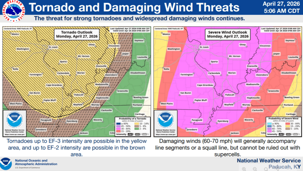
Severe weather is looking increasingly likely Monday night and into the overnight areas, as a powerful storm system will race across the region, bringing damaging winds and tornadoes with it.
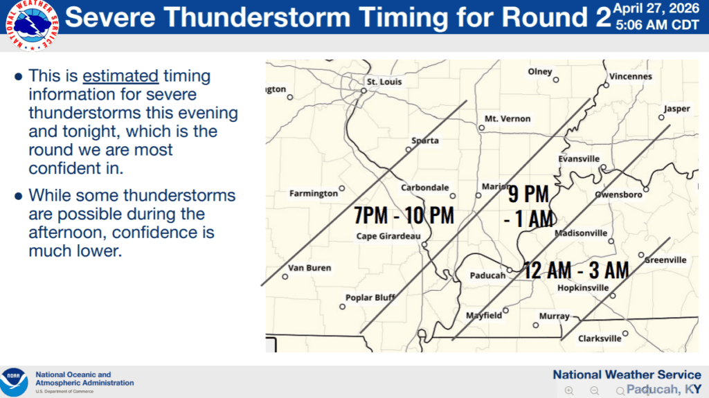
Some of those tornadoes could be strong, and the threat for large hail has increased as well, especially in any supercells that develop. The National Weather Service in Paducah is predicting that the storm system will begin as supercells in Missouri and Illinois and then possibly solidify into a squall line over western Kentucky.
Damaging winds would be the highest threat in a squall line, but tornadoes, some strong, would remain possible—that’s according to Lead Forecaster Dan Spaeth, who says the timeline for western Kentucky, including Christian, Todd and Trigg counties, would be around midnight to 3 a.m.
Make sure you have multiple ways to receive warnings that will wake you up, so you can shelter in your safe area if needed. Stay tuned to the WHOP Family of Stations for any watches or warnings that will arise during this severe weather event.