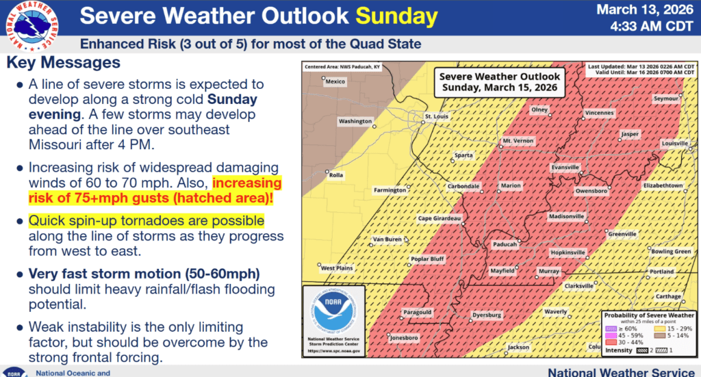
Western Kentucky is already under an Enhanced Risk for severe weather Sunday afternoon and into the overnight hours, as a line of storms will race through the region, chased by a cold front.
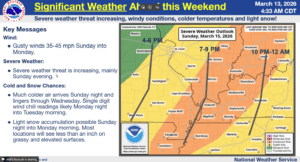
The main hazard is going to be damaging winds, with gusts during any storms that develop of up to 80 miles per hour possible. Meteorologist Derrick Snyder with the National Weather Service in Paducah says the storm front should enter our area between 7 p.m. and 9 p.m. and be heading east out of here by midnight.
Along with the high winds, which will be pretty blustery even outside of severe storms, a couple of spin-up tornadoes will be possible, along with large hail.
And this is truly the system that has it all, as the cold front will surge across the region and drop our seasonal temperatures right down into the winter category. Our precipitation might even switch over from rain to snow with that plunge, but Snyder says they’re expecting little to no accumulation from it.
Highs will only reach the mid-20’s on Monday and Tuesday, but then we’re set to warm right back up, continuing our Spring highs and lows. Stay weather aware this weekend, and stay tuned to the WHOP Family of Stations for any watches or warnings that may develop.