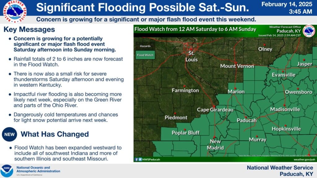
There is a Flood Watch in effect for all of western Kentucky from midnight tonight through 6 a.m. Sunday morning, with the potential there for significant flooding issues.
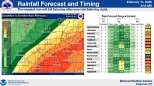
Rainfall amounts of two to four inches are in the forecast, with higher amounts certainly possible locally, possibly up to six inches. That could easily lead to flooding issues, as the ground is already saturated from recent rainfall.
So, Meteorologist Derrick Snyder with the National Weather Service in Paducah urges folks to stay weather aware this weekend and remember—turn around, don’t drown.
There also exists a marginal risk for severe weather this weekend, including damaging winds and a spin-up tornado, so stay tuned to the WHOP Family of Stations for more on this developing weather system.