

Following a rainy weekend, the wet weather is expected to stick around, and heat index values are set to decline slightly this week.
Meteorologist Justin Gibbs with the National Weather Service in Paducah says this week’s weather pattern could result in the declaration of some severe thunderstorm and flash flood warnings.
To start the work week, Gibbs says slow-moving thunderstorms will impact a large portion of their coverage region. Then, toward Thursday and Friday, a more organized storm system will likely impact the region and is expected to bring more rain and higher wind speeds than the current system.
Gibbs also expects heat index values to dip this week. He says during the summer it’s typical for thunderstorms to move in and cool things off.
The U.S. Drought Monitor was updated on Thursday and shows that drought conditions in Kentucky continue to improve. Gibbs says many areas that were experiencing extreme droughts are now experiencing abnormally dry conditions, moderate droughts and severe droughts, which are easier to manage.
Southern portions of Christian, Todd and Trigg Counties are still experiencing drought conditions, while the northern portions are experiencing abnormally dry or no drought conditions.
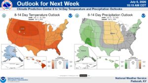
Looking to next week, Gibbs says temperatures are expected to be above normal while precipitation is expected to be below the seasonal average.