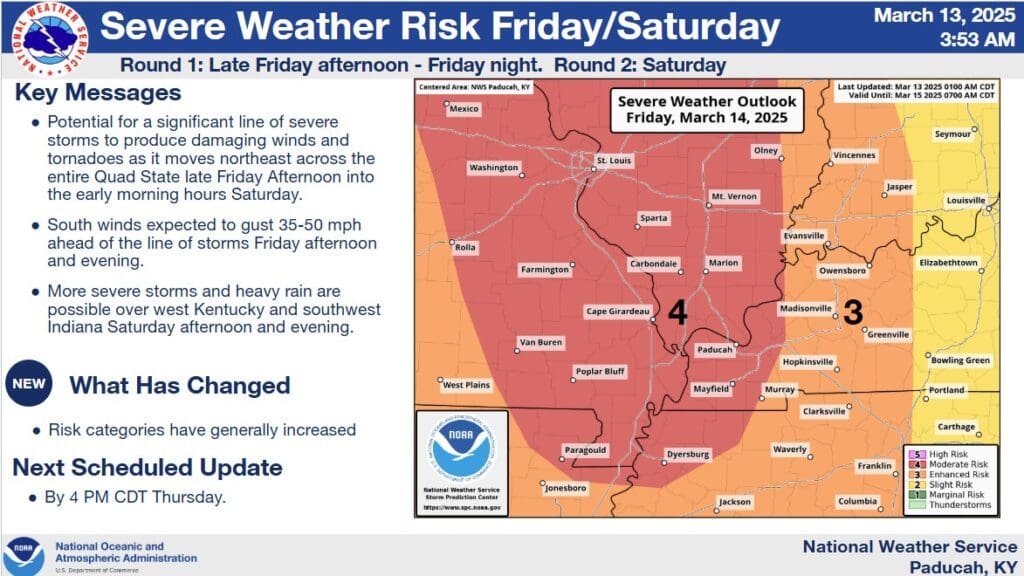
The ugly side of spring is certainly rearing its head after a beautiful week so far, with western Kentucky under Moderate and Enhanced Risks for severe weather starting Friday evening.
Officials with the National Weather Service in Paducah say they are becoming increasingly concerned for the possibility of widespread severe wind and the possibility of tornadoes, a couple of which could be strong. That’s if all the ingredients can align, but Meteorologist Justin Gibbs says if those storms do ignite, they’ll become nasty quick.
The severe weather likely won’t move into the Pennyrile region of western Kentucky until the evening hours, which means this will be an overnight event. Then, some severe storms could flare back up Saturday.
Gibbs reported that the Moderate Risk—which, right now, covers portions of far western Kentucky, while the Pennyrile is in an Enhanced Risk—is a rare one, so needs to be taken seriously.
Make sure you have multiple ways of receiving warnings, especially ones that will wake you up when they go off, and be ready to take action immediately should a warning be issued for your area. These storms will be moving very rapidly, so don’t wait for them to get to you before taking shelter.
Outside of any storms, its going to be downright windy across the region, with wind gusts of up to 40 miles per hour or more possible throughout the day Friday.