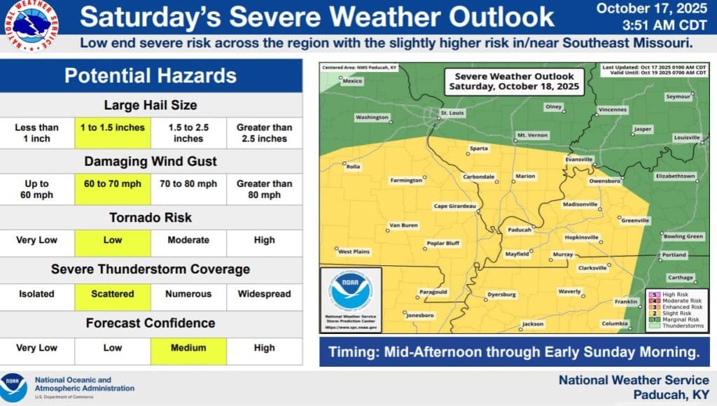
After an extended period of quiet weather, the fall severe weather season is set to break across the region on Saturday, with a Slight Risk for severe weather across all of western Kentucky.
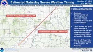
That includes in Christian, Todd and Trigg counties, with all hazards on the table, including large hail, damaging winds and a brief tornado can not be ruled out. The National Weather Service in Paducah says scattered thunderstorms will be possible in Missouri and southern Illinois, and that will meld into a squall line that will move into western Kentucky Saturday evening.
The greatest severe potential for our area will be between 7 p.m. Saturday and 1 a.m. Sunday morning.
Rainfall could also become heavy at times, so minor flooding issues could be possible in the usual low-lying and poor drainage areas.
Stay tuned to the WHOP Family of Stations for any watches or warnings that may develop.