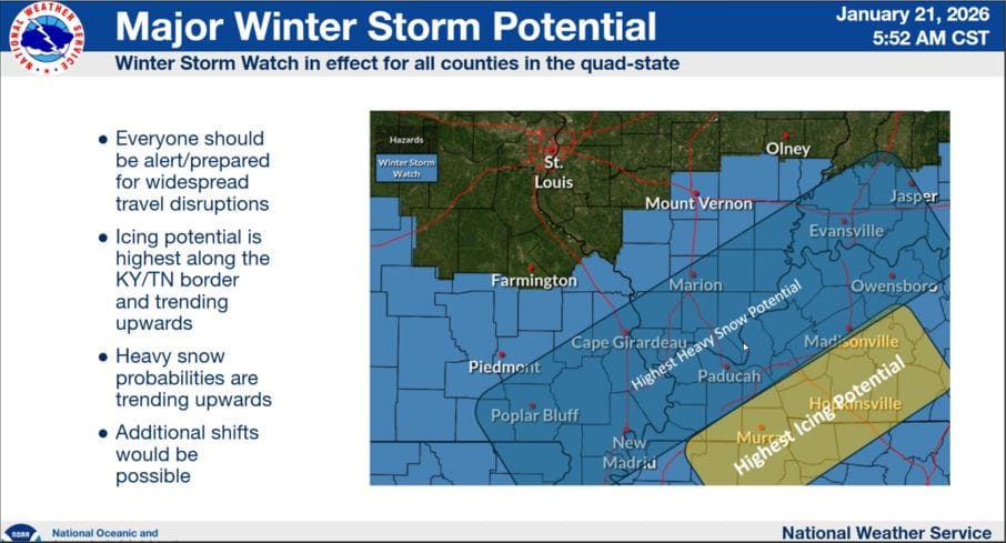
Things are trending upwards for our winter storm potential starting Friday night, with several inches of snow and now maybe even ice accumulations possible.
In a conference call Wednesday morning, Meteorologist Justin Gibbs with the National Weather Service in Paducah saying some areas could see anywhere between four to 13 inches of snow in their service region, and that includes Christian, Todd, Trigg and surrounding counties. There is a limiting factor possible, but it’s not a good one, as the potential for ice accumulations could make its way into counties along the Tennessee border—so major travel impacts are looking increasingly likely.
Dangerously cold arctic air will funnel into the region along with the snow, putting temperatures down into the single digits.
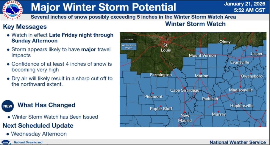
Gibbs says Winter Storm Fern will likely be a memorable one and they are highly confident that everyone will see at least a few inches of snow between Friday night and Sunday afternoon, so expect an upgrade to a Winter Storm Warning.
Gibbs says things could still change between now and then as they track where the main body of the storm will travel, but the median amount of possible snow the data is showing is around 9 inches, so people should start preparing now.
Crews are out pretreating roads across the region now to try and help minimize the impacts of wintry precipitation. Stay tuned to the WHOP Family of Stations and the National Weather Service in Paducah for any further watches or warnings that arise from this incoming winter storm.