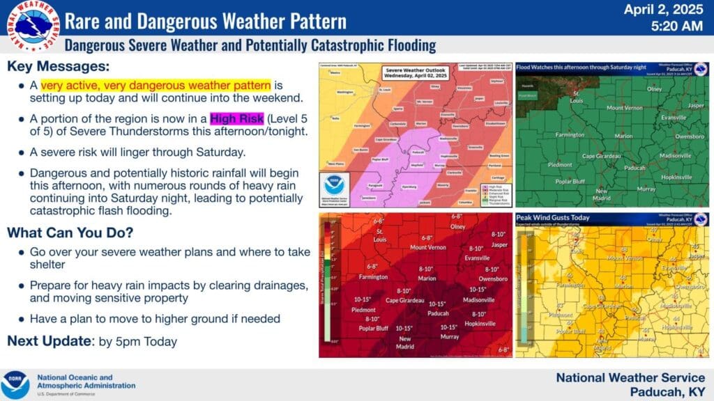
In an upgrade that no one wanted to see, portions of the area are now under a High Risk for severe weather Wednesday afternoon and into the evening.
A High Risk is pretty rare and shows that meteorologists with the National Weather Service Storm Prediction Center are feeling pretty confident that someone will get severe weather. And some of that weather could be significant, with extremely heavy rain, large hail, widespread damaging winds and tornadoes, some of which could be strong and long-tracked.
Meteorologist Justin Gibbs with the National Weather Service in Paducah says we could see a line of intense storms form and move through the area.
Portions of Trigg County and areas to our west are in the High Risk, while surrounding areas—including Christian and Todd Counties—are in the Moderate Risk. But don’t get hung up on the colors, as severe storms could spin up a tornado or spawn damaging winds anywhere in the risk areas.
The severe risk will linger through the rest of the week, before surging once again on Saturday, with all risks back on the table.
Meteorologists are also very concerned about the flooding event that will follow tonight’s storms, as it’s looking likely that most of the area could see major flooding, with parts of western Kentucky under the gun to possibly receive 10 to 15 inches of rainfall between Wednesday and Saturday.
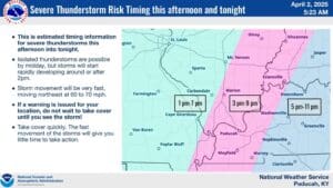
It’s looking like severe storm threat will peak in our area between 3 p.m. and 11 p.m. with all hazards on the table, so make sure your sheltering areas are ready to go. Have multiple ways to receive warnings and be ready to act immediately if a warning is issued for your area.
Stay tuned to the WHOP Family of Stations for any watches or warnings that may develop.


